Historic Maps
Map St. Augustine's Past.
|
 |
 |
 |
 |
1584, La Florida, Abraham Ortelius
Appointed by Philip II of Spain in 1575, Ortelius provided the first modern, standardized,
printed world atlas. This suppliment to that work marks the first known printing of a map of a North
American region; and bears several names that are still in use today; C. de Cañaveral, Totugas
(the Dry Tortugas), and Baya de S. Ioseph, among others.
 |
 |
  |
  |
 |
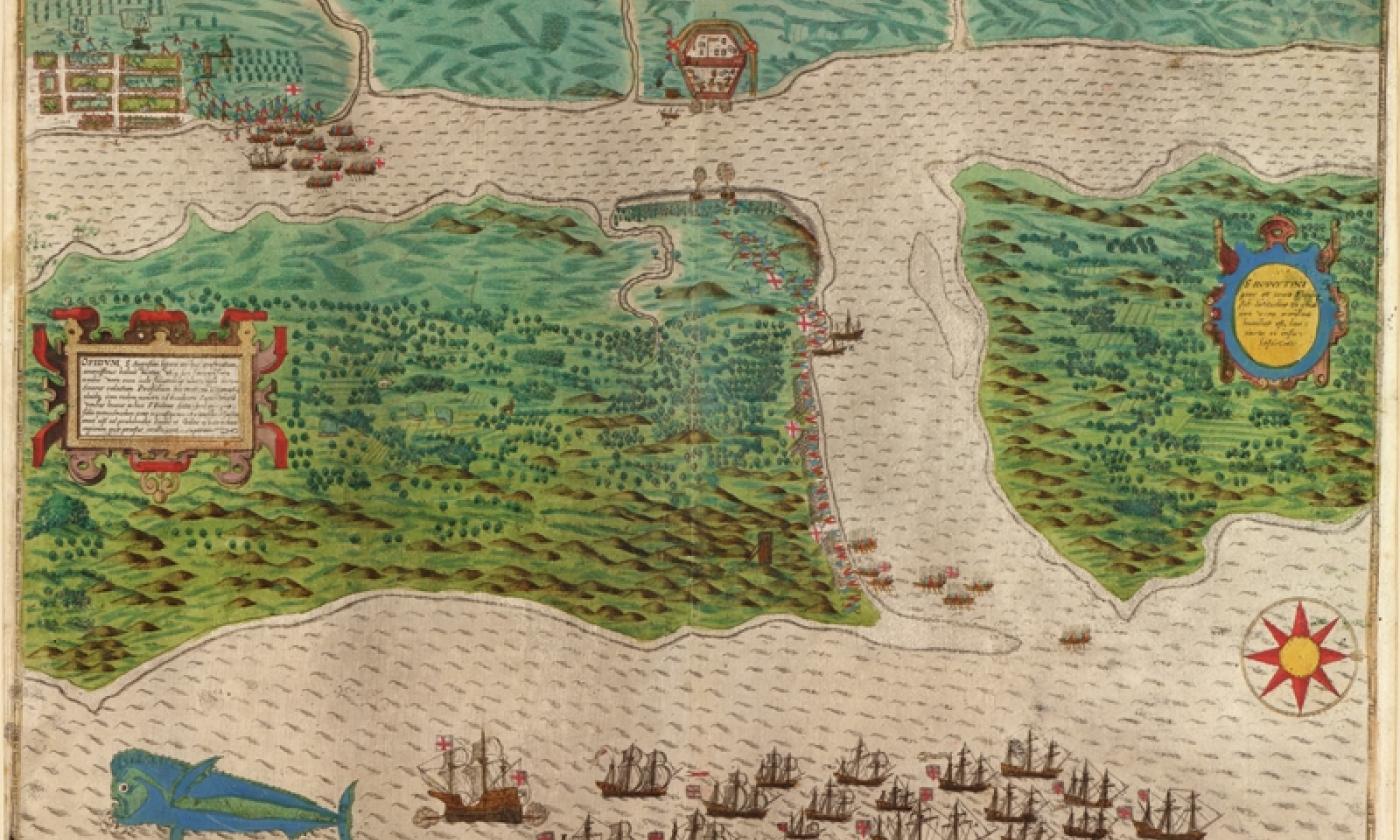
1589, St. Augustine, Drake
Hand-colored map by Baptista Boazio that depicts Sir Francis Drake's attack on Saint
Augustine on May 28 and 29, 1586. It portrays how the English corsair captured and burned the fort and
city of Saint Augustine.
 |
 |
  |
  |
 |
1591, Florida, Jacques Le Moyne
In Aplril 1564 Le Moyne sailed with René de Laudonniére as artist of the French
Huguenot expedition to Florida. In Septermber 1565 the Spaniards overran the colony, but he escaped and
returned to France. The map includes the peninsula of Florida and the surrounding regions from the northern
part of Cuba to Cape Lookout. Map provided from the Saint Augustine Historical Society's collection.
 |
 |
  |
  |
 |
1740, View of St. Augustine, Silver
A view of the town and castle of St. Augustine and the English camp before it June 20,
1740. In an impartial account of the late expedition against St. Augustine, under General Oglethorpe
against the spanish city of St. Augustine. It is inserted and was originally published in the
Gentleman's magazine for July, 1740. Map size is 6.5" x 11.75"
 |
 |
  |
  |
 |
1765, East & West Florida, Thomas Kitchin
A new and accurate map of east and west florida drawn from the best authorities.
Unsigned and undated. Published in "The London Magazine" in March 1765 v.34 pp. 120-121.
Excerpt from p. 120: "Florida, being now divided into two governments, or provinces, East-Florida
and West-Florida, and likely to become a very beneficial acquisition to this nation". Map size is 7" x 9"
 |
 |
  |
  |
 |
1768, North America & the West Indes, Thomas Jefferys
Pais Cedes, Sheet IId. Containing the Peninsula and Gulf of Florida, with the Bahama Islands.
 |
 |
  |
  |
 |
1768, North America & the West Indes, Thomas Jefferys
Florida from the latest authorities.
 |
 |
  |
  |
 |
1783, Plan of St. Augustin, John Bew
Plan of the town and harbour of St. Augustine in east Florida.
Plan originally published in London by Thomas Jefferys. Map size is 6.5" x 9.5".
 |
 |
  |
  |
 |
1727, West Indies, Herman Moll
A map of the west-indies with the adjacent countries. Also trade winds and several
tracts made by Galeons and Flota from place to place.
 |
 |
  |
  |
 |
1730, West Indies, Herman Moll
A chart of the West-Indies or the islands of America in the North Sea. Includes map insert
of Vera Cruz.
 |
 |
  |
  |
 |
1764, Plan du Port de St. Augustin, Jacques Bellin
From Jacques Nicholas Bellin, Petit Atlas Maritime, 1764. Hand-colored engraving.
Map size is 6.25" x 8.25".
 |
 |
  |
  |
 |
1819, Plan of St. Augustine, Birch
This 9.84inx15.55in map includes coastline, coastal features, navigational hazards, soundings, an
anchorage, a grid of the city, fortifications, roads, plantations, and pictoral representation of vegetation
and marshland. Notes on map refer to fields, orange groves, and to types of trees. Map is oriented with
West at top.
 |
 |
  |
  |
 |
1839, Florida Seat of War U. S. Army
Map was created during the Seminole War for Brig. General Zachary Taylor.
 |
 |
  |
  |
 |
1850, Florida, Thomas Cowperthwait
Published by Thomas, Cowperthwait & Co. Routes of the army during the Seminole
War including Forts, battlegrounds, and other landmarks. Has insets of St. Augustine, Pensacola,
and Tallahassee. Includes water route distances from St. Augustine.
 |
 |
  |
  |
 |
1861, Panorama of the Seat of War, John Bachmann
Birds eye view of Florida and part of Georgia and Alabama, drawn from nature and lith.
by John Bachmann. View of Florida and the environs showing towns, roads, railroads, forts, and rivers.
 |
 |
  |
  |
 |
1862, St. Augustine Harbor, U. S. Coast Survey
The chart depicts the town of St. Augustine just prior to the Civil War. Features include soundings in the harbor, sailing directions, street patterns and building locations.
 |
 |
  |
  |
 |
1864, Northern Part of Florida, Henry Lindenkohl
Northern part of Florida Drawn by H. Lindenkohl. Compiled and published at the United
States Coast Survey Office, A.D. Bach, Superintendent.
 |
 |
  |
  |
 |
1869, St. Augustine View, John Horton
"St. Augustine, Florida. Sketches of its history, objects of interest and advantages as a
resort for health and recreation." By an English visitor. Printed for E. S. Carr, St. Augustine, 1869.
56" x 4" map accompanied in book.
 |
 |
  |
  |
 |
1884, Saint Augustine, Max Bloomfield
Text from original book: Illustrated Historical Guide, embracing an account of the
antiquities of St. Augustine, Florida (with map).
A condensed guide of the St. John's, Ocklawaha, Halifax, and Indian Rivers.
Max Bloomfield, Bookseller, Newsdealer & Stationer.
10.5" x 6.8" map accompanied in book.
 |
 |
  |
  |
 |
1885, St. Augustine, Birds Eye View
Drawn by H. Wellge, published by Norris, Wellge & Swift, Brockton, Mass.
Map from the Saint Augustine Historical Society's collection.
 |
 |
  |
  |
 |
1887, St. Augustine Harbor, Black
Plate B show entrance and harbor of St. Augustine with depth of water,
shows potion of congressional report proposed jettys, part of report for 1888
by Corp of Engineers. Map size is 9" x 11"
 |
 |
  |
  |
 |
1898, Florida East Coast Railway Map
Published for Flroida East Coast Railway and Florida East Coast Steamship Co., "The East
Coast of Florida is Paradise Regained"
 |
 |
  |
  |
 |
ca. 1900, Florida and Adjacent Islands, Jacksonville, St. Augustine and Indian River Railway
East Coast Line, the St. Augustine route and connections. This map is absolutely
correct in all the geographical details, and every railroad is shown in its proper location.
The Matthews Northrup Co.
 |
 |
  |
  |
 |
1911, St. Augustine Inlet, Coastal Survey
St. Augustine to the Halifax River.
 |
 |
  |
  |
 |
1914, St. Augustine in Perspective, Wyllie
Tourist map of Saint Augustine highlighting featured hotels, street car lines and attractions.
Covers areas from north San Marco Ave., historic downtown, to what is now Lincolnville.
Each square depicts a 1/4 mile of area. 26" x 8.5" Drawn & Copyrighted by H. S. Wyllie.
 |
 |
  |
  |
 |
1917, St. Augustine
Possible geodetic survey of St. John's county. Good detail of St. Augustine,
Saint Augustine Inlet, and what was then Chautanqua Beach.
 |
 |
  |
  |
 |
1920's, Florida Auto Trails Map, Rand McNally
This is a junior auto trails map of florida. Some routes shown include St.
Augustine Road, Old Spanish Trail, and Dixie Highway. Dimensions are 12" x 16".
 |
 |
  |
  |
 |
1981, St. Augustine, Dept. of Interior
30 x 60 minute quadrangle including contours and elevations in meters, highways, roads,
and other manmade structures.
 |
 |
  |
  |
 |
1992, St. Augustine Quadrangle
National geodetic vertical datum of 1929. Contour Interval appears every 5 feet, and
the scale is 1:24,000. Was photoinspected from 1989 and boundaries and names revised in 1992.
 |
 |
 |
 |
|     |